
Local government
- Aerial photography and online geo-spatial information system to facilitate local government tasks.
Easy to use, quick to learn, time and cost effective.
How can we help local governments?
By providing (periodic) aerial surveys, their evaluation and, on request, a complete online geo-spatial information system (GIS).
Aerial photography is used to produce orthographic photos, so-called orthophotos. The data and information carried by the images are entered into an online geoinformatics system.
In case of landmark monuments, a detailed laser scanning (LIDAR) survey can be carried out to accurately assess the current condition, to establish a digital twin.
Thanks to the orthophotos that we take regularly and our online spatial information system, we can easily monitor changes from time to time in the condition of public spaces, parks, pavements, buildings, forests and the changes that occur in them. Illegal construction, tree felling or waste dumping can be tracked much easier from the bird's eye view on an office computer than from the often cumbersome site visits. The digital twin and online GIS system also facilitates working from home during challenging times.
What are the benefits of our online geospatial system?
– Touch-free (Covid kompatibilis), akár otthonról is elérhető
– quick to learn
– Cost- and time-effective (we have solutions for everything from tree cadastre to cemetery spatial information)
– Easy to use
Our online geospatial system (GIS) saves time, money, human resources and energy. The primary purpose of regularly producing records is to provide up-to-date data on municipalities. This allows the actual status of the properties to be updated, which will provide the municipality with an accurate, up-to-date building inventory, which is a key factor in the assessment of determining accurate property tax.
Within our geographic information system, we can integrate different layers for a surveyed area, such as:
– cadastral base map, real estate cadastre,
– orthophoto images
– town and country planning plans, and regulatory plans
– utility maps (rainwater, sewage, electricity, gas, telecommunications, street lighting, etc.)
– indication of rights to use public land with a permit
– tax-, spatial planning-, traffic-registers, etc.
– public space content (technical map)
– municipal properties
– cellar register
– cadastral register, tree register
– digital photographs
No need for expensive, powerful workstations and special software. All that is needed is a computer with a good internet connection and access to the system by any number of colleagues, provided they have the right level of access rights.
In what specific areas can we help local authorities?
In the area of building authority and building control:
– Monitoring of investments and construction works.
In the field of urban development:
– Maintenance, control and monitoring of public spaces
– Green Infrastructure Development and Maintenance Action Plan
In the field of urban management:
– Mapping of external and internal areas belonging to settlements.
– Control of tree felling (in case of unauthorized felling or felling along disputed property boundaries)
– Registration of cemeteries
Environmental protection area:
– Illegal dumping of waste
Land registry area:
– Accurate detection of property boundaries
Have further questions?
If you would like to learn more about any of the above, or if you are looking for a solution to an existing challenge, please contact us! There is no wrong or unnecessary question.
Our colleagues will be happy to help you and provide you with concrete suggestions for solutions!

Road, rail, and linear infrastructure facilities
- Transparency of large-scale projects with aerial photography during the design, construction, handover and maintainance phases.
Cost effective design, immediate intervention, 3D model, vector data extraction for turnkey solutions.
How can aerial photography help your construction project?
Our services can effectively support the entire investment process during the realisation of major linear infrastructure installations:
– Preparation of the project
- During the construction process
- During technical handover
- during operation
What are the key benefits?
When preparing investments, it is of paramount importance to assess and record the baseline conditions. By recording the baseline condition, aerial mapping provides accurate information on environmental conditions such as terrain, the location of existing objects and structures, and helps to improve planning and thus leads to cost-effectiveness. The digital files allow objects in the field to be measured and inspected afterwards from the office.
No plans of the current state? No problem, we use our images (and LIDAR point clouds) to create a 3D model of the transport system and terrain conditions what can be used as turnkey solution files for your design.
During the construction process, periodic aerial surveys can be used to check the current status, the stage of completion and easily compare the actual condition with the expected schedule, while we generate information for BIM systems (in the form of automatic volume and quantity statements) - which also adapts to your current workflow. The extra benefit of exploiting these possibilities - in addition to the transparency of the entire project - is that it allows for immediate, real-time intervention planning in case of need (e.g.: deviation from plan, backlog, incorrect execution).
At the end of the construction project, we can identify discrepancies between planned and completed facilities, and the digital files and cadastral map can be easily compared and displayed on demand on a single platform, in line with the requirements of the authorities and the land registry.
The accurate and correct execution can be easily verified and produced as a 3D model on demand.
During operation, digitalisation and recording of existing conditions play a key role in the cost-effective operation of the facilities. The knowledge of the current conditions is essential to perform the appropriate level of preventive maintenance/operations and development - planning tasks.
Have further questions?
If you would like to learn more about any of the above, or if you are looking for a solution to an existing challenge, please contact us! There is no wrong or unnecessary question.
Our colleagues will be happy to help you and provide you with concrete suggestions for solutions.
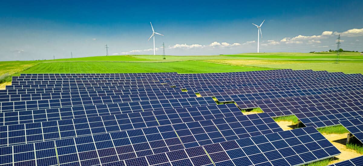
Energy installations
- Support for the installation and operation of low, medium and high voltage overhead lines and additional facilities for the energy distribution system.
Effective support for the deployment and safe operation of solar parks.
Prevention of failures, minimisation of forced outages.
Fast and safe troubleshooting.
Aerial monitoring of energy distribution infrastructure: how can it be useful?
- safe operation: powerline - structure gauge inspection, line sagging inspection
- fast and safe fault detection
- design of new installations, support for operation
How?
Prevention through regular condition surveys
Whether it is an above ground energy installation, safety is of paramount importance: the safety of those working in the area and the safety of the nature surrounding the industrial sites. Recording of baseline conditions and periodic surveys reveal the condition of the energy installation (e.g. condition of network elements, line sagging, load), so that we can see where there are areas that need intervention and repair. Our precision tools can also spot anomalies that are not visible to the human eye.
Timely, planned intervention can prevent faults and avoid forced outages. Our company provides effective support that saves lives.
Fast and safe fault detection
Visual inspection on site is usually very difficult, time-consuming and dangerous.
With aerial surveys, we can quickly, efficiently and safely identify the locations of necessary interventions, make maintenance tasks predictable and minimise downtime. This saves operators time and money. At the same time, it is unnecessary to risk the safety of people working at height by assessing the causes of failures. With our state-of-the-art drones, we not only minimise, but reduce to zero, the exposure of the colleague in charge of finding the fault.
Supporting the development of new facilities and operations
We offer aerial photography and digital elevation models for a wide range of energy installations, mainly to increase the efficiency, control and safe operation of their operations.
- Support for the operation of overhead transmission lines and electrical industrial installations
- Assessment of solar farm operations (e.g. damaged, contaminated, overheated panels)
- Assessment of the operation of wind farms, installation of new ones (e.g.: accurate mapping of topography)
- Assessment of hydroelectric power plant operation, installation of new ones (e.g.: identification of flow conditions and environmental characteristics)
- Other renewable energy potential assessment and analysis (e.g. biomass yield)
Once the surveys are completed, our company does not just send pictures or videos to the client, but a detailed study, including all the details of the survey results, to understand your challenge and provide a tailor-made solution.
Have further questions?
If you would like to learn more about any of the above, or if you are looking for a solution to an existing challenge, please contact us! There is no wrong or unnecessary question.
Our colleagues will be happy to help you and provide you with concrete suggestions for solutions.
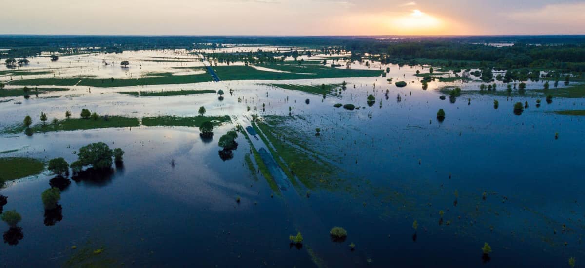
Water management and flood protection
- Drainage map for prevention and planning.
Aerial photography for fast and efficient rescue.
Effective support for damage prevention.
Our technologies provide effective support in various areas of water management and flood protection:
– Operation
– planning
– intervention monitoring
– monitoring and management
We survey the desired area, Once the desired area has been surveyed, we identify sensitive areas and areas at at risk thanks to the precise evaluation of the data.
Intermittent flooding and inland flooding can cause devastation equivalent to a natural disaster. It can cause serious damage to the built environment, natural areas, but in critical cases it can also endanger human lives.
How can aerial photography help?
Surveying, modelling and analysing the area at risk of high inland water levels and flood risk can be an effective tool for both prevention and rescue after a flood has occurred, as well as for minimising the damage.
In order to prevent flooding due to floodplain erosion, bed deredging is essential. However, an accurate model of the riverbed to determine where and how much excavation is needed is a great help for effective underwater works.
During periodic inspections of dams, we highlight critical deep and weak points. This makes it possible to plan maintenance. Preventive, safety measures can be taken in critical areas to minimise the number of potential flooded areas.
Water management for prevention
Aerial photography results in a model of the topography of the area and a drainage map. The latter will help us identify the areas most at risk and take preventive measures to ensure the safety of people living in flooded areas and protect their property. We work with water professionals to produce data that they can use.
Flood protection to provide rapid assistance and minimise damage
Once flooding has occurred, the damage to property is, with a few lucky exceptions, always significant. More importantly, people in the area may also be at serious risk. In this case, one of the most effective methods is aerial mapping: we will identify the areas at critical risk as quickly as possible.
Aerial photography provides much more meaningful information than photography from the ground, as it covers a much larger area. Locating water dams in poor condition can save lives.
Before restoration work begins, it is worth having aerial photographs taken for the following benefits:
by analysing our images, we can tell exactly where and how many cubic metres of water need to be removed, and where the dams have been damaged. This will allow us to plan the use of human and machine resources, speed up the rescue operation and minimise the damage.
Have further questions?
If you would like to learn more about any of the above, or if you are looking for a solution to an existing challenge, please contact us! There is no wrong or unnecessary question.
Our colleagues will be happy to help you and provide you with concrete suggestions for solutions.

Buildings, architecture
- Cost-effective workflows for the design, construction and operation phases of a building.
Transparency, controllability.
Immediate intervention, 3D model.
Aerial geodesy can be an effective tool for building design and architecture. It makes the design and construction process easier, more accurate, faster and therefore more cost-effective.
Available during
– the preparation of investments
– the construction process
– the end of a project
What are the benefits?
During the preparation of construction works, including the design phase, it is of paramount importance to assess and record the baseline condition. Aerial mapping can be used to determine the initial topographic or architectural condition with absolute realism and dimensional accuracy, by building a digital twin of the existing conditions. This can serve as a reference for continuous monitoring of the works.
Aerial surveys can be easily combined with ground surveys, indoor and outdoor surveys and CAD drawings to integrate the results in a BIM workflow.
With our services, this verification is simple: comparing the original condition with the images taken during periodic surveys gives a clear picture
– of the current status of the construction site,
– the state of completion,
– the difference versus the expected schedule.
Not only does this make the construction process fully transparent, it also allows immediate intervention if necessary (e.g. deviation from the design, backlog, incorrect execution).
Once the construction project is completed - the planned facilities, digital files and cadastral map can be easily compared and displayed on a single platform.
As part of our service, we can also produce a 3D model to aid the verification process.
The digital files also provide an excellent basis for presenting the investment, creating animated videos to visualise the communication to the client.
Have further questions?
If you would like to learn more about any of the above, or if you are looking for a solution to an existing challenge, please contact us! There is no wrong or unnecessary question.
Our colleagues will be happy to help you and provide you with concrete suggestions for solutions.

Mining
- Fast and accurate recording.
Precise determination of the quantity extracted by unmanned aircraft for surface mining and by robot ship for underwater mining.
Immediate data (area, volume).
If a quick, yet reliable and accurate measurement is required, airborne or underwater recording can provide a solution.
The measurement of the volume of material extracted from mines, material extraction sites, material deposits and stockpiles is important for several reasons.
Accurate measurements are essential to protect mineral resources. Thanks to our precision technology, we are able to accurately determine the volume of extracted minerals, thus avoiding possible misunderstandings in accounting not only through calculations and measurement reports, but also through photographic documentation. Plan extraction areas based on a 3D digital model of the area.
MiWhat are the advantages of aerial or underwater photography/scanning for mines?
For mines, a large amount of measurement data is needed to accurately determine the material to be extracted. This is where aerial geodesy can help. What the ground geodesist measures in a day, we measure in more detail in an hour. With aerial geodetic surveying, we can quickly and easily measure surface areas (up to millions of measured points) as opposed to point measurements in traditional practice.
A survey can be completed in minutes, and evaluated to give an accurate picture of the volume extracted.
Our services include not only conducting the survey, but also the post-processing: the evaluation stage which gives an accurate picture of the mining area. For surface mines, we use unmanned aerial vehicles (photogrammetry or LIDAR), and for underwater mines, we use robotic unmanned surface vessels and sonar.
The analysis work includes, on request, orthophoto mosaics, elevation models, laser scanner point clouds, animated videos, point clouds and level maps of the surface with a measurement accuracy of up to 2 cm.
Survey phases:
Periodic recording and evaluation is recommended during continuous mining operations. It is important to record the baseline condition, as this will serve as a reference.
Periodic surveys are used to monitor the changes in the mine (or the lakebed) during the interventions: this ensures both up-to-date information and transparency.
Have further questions?
If you would like to learn more about any of the above, or if you are looking for a solution to an existing challenge, please contact us! There is no wrong or unnecessary question.
Our colleagues will be happy to help you and provide you with concrete suggestions for solutions.

Heritage protection, archaeology
- Archaeological site excavation and documentation.
Monument and heritage conservation status assessment.
Landscape reconstruction.
UAV (unmanned aerial vehicle) technology is playing an increasingly important role in archaeology, whether it is for the exploration of archaeological sites or the mapping of excavations. This is because aerial photography can reveal details that would be missed by traditional ground-based photography.
A large site can be covered in a single flight, which speeds up the process of identifying new sites accurately.
In addition to the speed of aerial photography, the use of LIDAR offers other advantages that would not be possible without the tool: it can also be used to map heavily forested and vegetated areas (e.g.: castle battlements).
In addition, near- and far-infrared imagery can be used to draw further conclusions:
The former can be used to observe signs of vegetation indicating an archaeological phenomenon.
The latter, taken in the far infrared, i.e. in the thermal range, can be used to reveal changes in the heat balance of the soil that may be linked to archaeological phenomena.
Typically, UAV technology:
- archaeological site excavation
- documenting the excavation
- historic and heritage conservation surveys
- landscape reconstruction (the digitised data can be used as the basis for a virtual reality)
Have further questions?
If you would like to learn more about any of the above, or if you are looking for a solution to an existing challenge, please contact us! There is no wrong or unnecessary question.
Our colleagues will be happy to help you and provide you with concrete suggestions for solutions.

Forestry, nature conservation
- Forest and wildlife condition assessment by aerial photography.
Change monitoring.
Accurate identification of areas requiring intervention.
Conservation of our natural treasures is a high priority. As climate change intensifies, monitoring forests and protected areas is not only an opportunity but also a chance to track changes in our habitats, so that we have a realistic chance of intervening in time, if necessary, to ensure sustainability.
What are the benefits of aerial mapping?
Approaching a work site is often very difficult or even impossible, either because of weather conditions or the terrain. In such cases, traditional survey/reconnaissance methods are not appropriate. However, aerial survey - using unmanned aerial vehicles - can be used to quickly and professionally survey any difficult terrain. The information content of aerial photography is many times greater than that of ground photography. Another advantage of aerial surveys is that they can be carried out without disturbing the wildlife in the area.
What can we learn from the evaluation of an aerial survey?
The initial survey itself provides a comprehensive picture of the current state of the site and serves as a benchmark for (re)evaluation of a survey at a later date.
It can provide a more accurate picture of the health and condition of forests and other habitat types, species composition, numbers of endangered plant and animal species, etc.
The comparison of surveys carried out at different points in time can also shed light on the need for intervention and the exact location of intervention (e.g. due to pest degradation, natural disasters, or even wildlife damage).
Have further questions?
If you would like to learn more about any of the above, or if you are looking for a solution to an existing challenge, please contact us! There is no wrong or unnecessary question.
Our colleagues will be happy to help you and provide you with concrete suggestions for solutions.
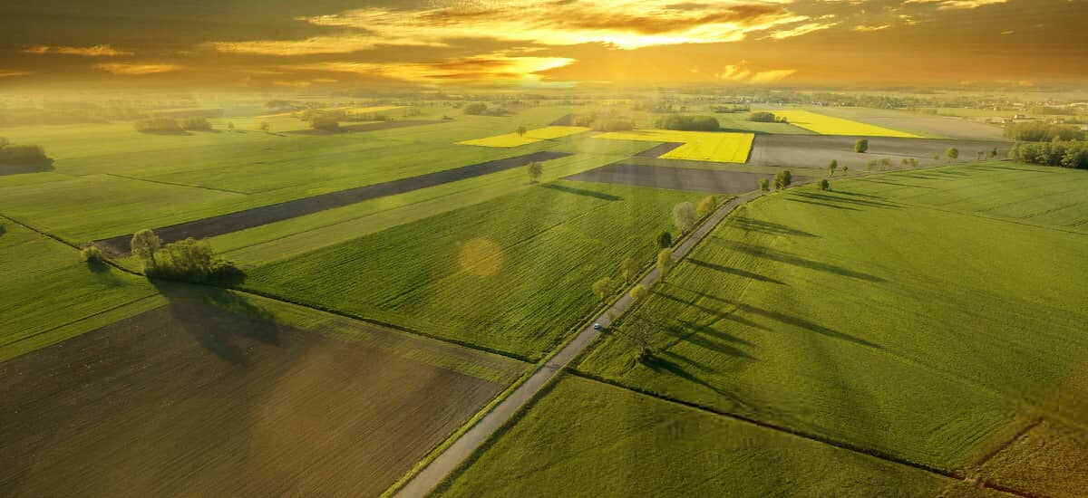
Agriculture
- Airborne health monitoring is an essential pillar of precision agriculture, allowing us to quickly and efficiently determine the necessary and sufficient interventions for efficient agricultural management through airborne monitoring.
Simple condition assessment.
Quick and efficient identification of intervention points.
The driving force behind precision agriculture is the use of drones to assess vegetation condition. Precision sensors are used to quickly and efficiently determine the necessary and sufficient interventions to ensure that only the required amount of chemicals and/or nutrients are applied to the area under investigation by the controlled agricultural machinery. Using aerial imagery from unmanned aircraft, critical condition assessment tasks that were previously unimaginable can be carried out quickly and easily.
What are these critical tasks?
In agriculture, there are many situations that can arise that require urgent or even immediate intervention.
These may include, but are not limited to:
- identification of over- or under-irrigated areas
- over- or under-watered or under-watered area
- detection of a deteriorating vegetation condition
- detection of crop development below expectations
How can aerial photography help in an agricultural area?
Knowing exactly when and where to intervene can save time, energy and money, as well as prevent further spread of damage.
To give a simple example: in the case of a crop infestation, there is no need to spray the whole area, as we can use the data to pinpoint the exact location of the crops to be sprayed. Faster, more efficient, cheaper.
Have further questions?
If you would like to learn more about any of the above, or if you are looking for a solution to an existing challenge, please contact us! There is no wrong or unnecessary question.
Our colleagues will be happy to help you and provide you with concrete suggestions for solutions.
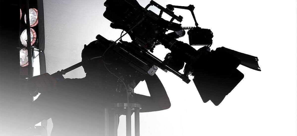
Film projects
- Production of video animation, film cataster and digitisation of filming locations for the design of film backgrounds.
During the preparation of investment projects, we can help you by creating a visualization that shows the planned facility in a way that people can understand, by digitizing the real environment.
In addition to animated videos, we provide effective support to the film industry by providing scale-accurate, geo-referenced digitisation of filming locations, made available on an online platform in a cadastral system. This allows for optimal planning of a location and saves hours of work.
But how and what is a film cadastre?
In simple terms, a film catalogue is the digitisation of possible filming locations. Thanks to digitisation, planning processes such as:
- "virtual" set-up and design of film locations,
- designing lighting and camera technology,
- the organisation of the sound system,
- organising logistics tasks
It is not only advisable to put a lot of effort into the organisation of a shoot, it is practically impossible to avoid it. The vehicles used range in size from cars to trucks. Some of these need to be mobile (cars, vans) and others need to be parked (e.g. catering, grippy trucks, camera trucks, aggregator trucks).
And if a shoot takes place in not one, but often 3 or 4 different locations, the importance of good logistics is again overrated.
Thanks to the film cataster, including the LIDAR tool, it is possible to analyse, organise and plan detailed exteriors and interiors online, without the need for a traditional survey of the location.
Possible locations are digitised, allowing the set designers, lighting, sound and camera crew to plan ahead. By doing all this in advance, rather than on location, they save valuable man-hours and costs.
This technological advance also allows the organisation and planning to start remotely from another city or country. In fact, the entire organisation can be done remotely. In this case, there is no possibility to revisit the location, to survey it, as the journey itself would take days, depending on the distance, but the solution is to retrieve the digital location.
Another advantage is that the necessary lighting and sound equipment can be planned in advance.
Have further questions?
If you would like to learn more about any of the above, or if you are looking for a solution to an existing challenge, please contact us! There is no wrong or unnecessary question.
Our colleagues will be happy to help you and provide you with concrete suggestions for solutions.
CONTACT
Contact us
Please contact us with any questions or requests for quotations.
Our email address
Our phone number
Office address
1112 Budapest, Rétalja lejtő 9.
2040 Budaörs, Ág u. 1/a
Company Info
Tax Number: 25335354-2-13
Company Reg. No.: 13-09-176420